Saturday, 25 July 2009

China dust cloud circled globe in 13 days

China dust cloud circled globe in 13 days


Dust clouds generated by a huge dust storm in China's Taklimakan desert in 2007 made more than one full circle around the globe in just 13 days, a Japanese study using a NASA satellite has found.

When the cloud reached the Pacific Ocean

the second time, it descended and deposited some of its dust into the sea, showing how a natural phenomenon can impact the environment far away.

"Asian dust is usually deposited near the Yellow Sea, around the Japan area, while Sahara dust ends up around the Atlantic Ocean and coast of Africa," said Itsushi Uno of Kyushu University's Research Institute for Applied Mechanics.

Article continues

Ocean current switch due to warming could be slower than feared

CHICAGO — The nightmare global warming scenario which provided the plot for a Hollywood blockbuster -- the Atlantic Ocean current that keeps Europe warm shuts down and triggers rapid climate change -- has long worried scientists.

But a study published Thursday in the journal Science found it may not occur as quickly as previously feared.


There is evidence that this current has shut down with some regularity in the past -- and sometimes quite rapidly -- in response to large influxes of fresh water from melting glaciers.

However, it appears as though the current rate of glacial melt is occurring at a more gradual pace which will "give ecosystems more time to adjust to new conditions," said study coauthor Peter Clark, a professor of geosciences at Oregon State University.

Article continues

NOAA Reports Record Ocean Surface Temperatures for June

From: , Global Warming is Real, More from this Affiliate
Published July 21, 2009 07:30 AM

The National Oceanic and Atmospheric Administration (NOAA) has reported findings of preliminary analysis from the agency's National Climatic Data Center in Asheville, North Carolina that shows global ocean surface temperatures for June broke the previous record set in 2005.

The combined average global/land and ocean surface temperature for June was the second warmest on record, 1.12 degrees Fahrenheit (0.62 degrees Celsius) above the 20th century average of 59.9 degrees F.

Ocean surface temperatures for June '09 were the warmest on record, 1.06 degrees F (0.59 degrees C) above the 20th century average of 61.5 degrees F.

The global land surface temperature for June was 1.26 degrees F above the 20th century average, and the sixth warmest June on record.

Article continues: http://www.globalwarmingisreal.com/blog/2009/07/20/noaa-reports-record-ocean-surface-temperatures-f

How Clouds Over the Oceans Affect Our Climate

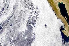
How clouds over the ocean affect our climate, and how climate change

may be affecting THEM, is not well known. There is no network of observing stations like on land, and climate models have not been shown to really simulate clouds well. They may be just too fine a detail for models that cover such large scale phenomenon as oceanic circulation. But clouds over the oceans have been thought be important in our understanding of what drives our climate.


In a study published in the July 24 issue of Science, researchers Amy Clement and Robert Burgman from the University of Miami's Rosenstiel School of Marine and Atmospheric Science and Joel Norris from Scripps Institution of Oceanography at UC San Diego begin to unravel this mystery. Using observational data collected over the last 50 years and complex climate models, the team has established that low-level stratiform clouds appear to dissipate as the ocean warms, indicating that changes in these clouds may enhance the warming of the planet.
The result of their analysis was a surprising degree of agreement between two multi-decade datasets that were not only independent of each other, but that employed fundamentally different measurement methods. One set consisted of collected visual observations from ships over the last 50 years, and the other was based on data collected from weather satellites.


"The agreement we found between the surface-based observations and the satellite data was almost shocking," said Clement, a professor of meteorology and physical oceanography at the University of Miami and winner of the American Geophysical Union's 2007 Macelwane Award for her groundbreaking work on climate change. "These are subtle changes that take place over decades. It is extremely encouraging that a satellite passing miles above the earth would document the same thing as sailors looking up at a cloudy sky from the deck of a ship."
Together, the observations and the Hadley Centre model results provide evidence that low-level stratiform clouds, which currently shield the earth from the sun's radiation, may dissipate in warming climates, allowing the oceans to further heat up, which would then cause more cloud dissipation.


"This is somewhat of a vicious cycle potentially exacerbating global warming," said Clement. "But these findings provide a new way of looking at cloud changes. This can help to improve the simulation of clouds in climate models, which will lead to more accurate projections of future climate changes. "

For more information: http://www.universityofcalifornia.edu/news/article/21575

Friday, 3 July 2009

Great Lakes wolves returning to endangered list

From: AP via MSNBC

The federal government on Monday agreed to put gray wolves

in the western Great Lakes region back on the endangered species list — at least temporarily.

The decision came less than two months after the U.S. Fish and Wildlife Service discontinued federal protection for about 4,000 wolves in Michigan, Minnesota and Wisconsin. The agency acknowledged Monday that it erred by not holding a legally required public comment period before taking action.

Under a settlement with five environmental and animal protection groups that had sued the agency earlier this month, the Fish and Wildlife Service said it would return Great Lakes wolves to the list while considering its next move.

Sea Ice At Lowest Level In 800 Years Near Greenland

New research, which reconstructs the extent of ice in the sea between Greenland and Svalbard from the 13th century to the present indicates that there has never been so little sea ice as there is now. The research results from the Niels Bohr Institute, among others, are published in the scientific journal, Climate Dynamics.There are of course neither satellite images nor instrumental records of the climate all the way back to the 13th century, but nature has its own 'archive' of the climate in both ice cores and the annual growth rings of trees and we humans have made records of a great many things over the years - such as observations in the log books of ships and in harbour records. Piece all of the information together and you get a picture of how much sea ice there has been throughout time.

"We have combined information about the climate found in ice cores from an ice cap on Svalbard and from the annual growth rings of trees in Finland and this gave us a curve of the past climate" explains Aslak Grinsted, geophysicist with the Centre for Ice and Climate at the Niels Bohr Institute at the University of Copenhagen.

In order to determine how much sea ice there has been, the researchers needed to turn to data from the logbooks of ships, which whalers and fisherman kept of their expeditions to the boundary of the sea ice. The ship logbooks are very precise and go all the way back to the 16th century. They relate at which geographical position the ice was found. Another source of information about the ice are records from harbours in Iceland, where the severity of the winters

have been recorded since the end of the 18th century.

Article continues: http://www.sciencedaily.com/releases/2009/07/090701102900.htm

ShareThis